
UPDATED 5th June 2014
The planning inquiry examining Cherwell District Council’s local plan for the period up to 2031 has been suspended following comments by the planning inspector, Nigel Payne, that current housing targets may be too low. CDC may now need to make changes to the local plan, which will involve further public consultation, and the hearing could be delayed until December.
Further details from a Bicester Advertiser feature can be seen here or here.
UPDATED 26th May 2014
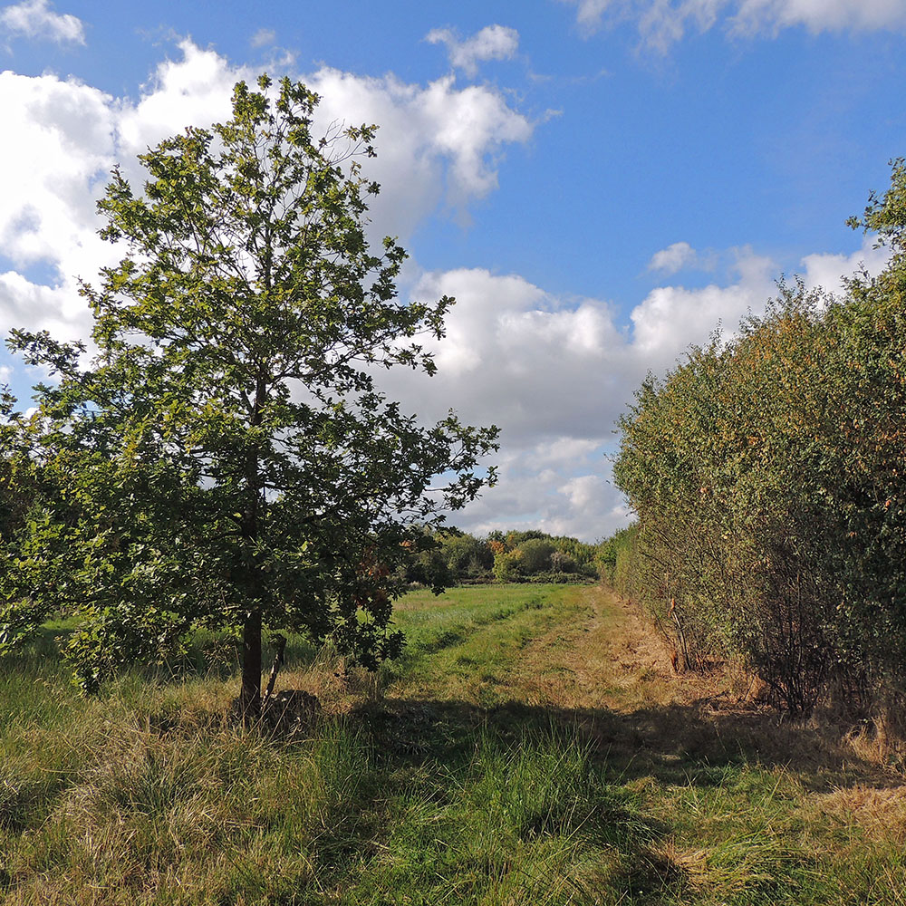
We hope shortly that we also can have guided walks to see wild-life at Gavray Meadows. At the moment the ragged robin is in full flower and soon there will be early orchids out. We need your support to ensure the survival of this local wild-life site.
The Independent Examination for the Cherwell Local Plan 2006-2031 will take place at Bodicote House beginning on Tuesday 5th June at 9 30 am. The essential days when the future of Gavray Meadows should be discussed are Tuesday 10th and Wednesday 11th June. To support us please email councillors Dan Sames and Lynn Pratt saying that you want to preserve this site for wild-life and do not want it built on.
A recent feature on Gavray Meadows from the Bicester Review can be viewed here.
UPDATED 11th March 2014
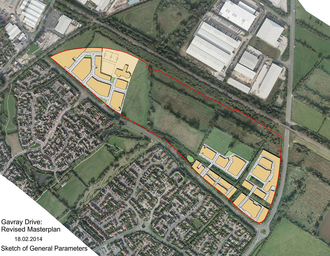
Gallaghers have now produced a revised Masterplan for the Gavray Drive development showing a reduced area of housing.
Further details can be accessed via the CDC Planning webpage, and entering 14/00001/SCOP in the “Search” box. Select the “Documents” tab, then click on “View associated documents”.
“Scoping Report – Part 1” (5.3Mb download) is an environmental impact assessment produced by David Lock Associates, and “Scoping Report – Part 2” (9.6Mb download) is habitat mapping of resident wildlife compiled by Environmental Dimension Protection.
UPDATED 17th February 2014
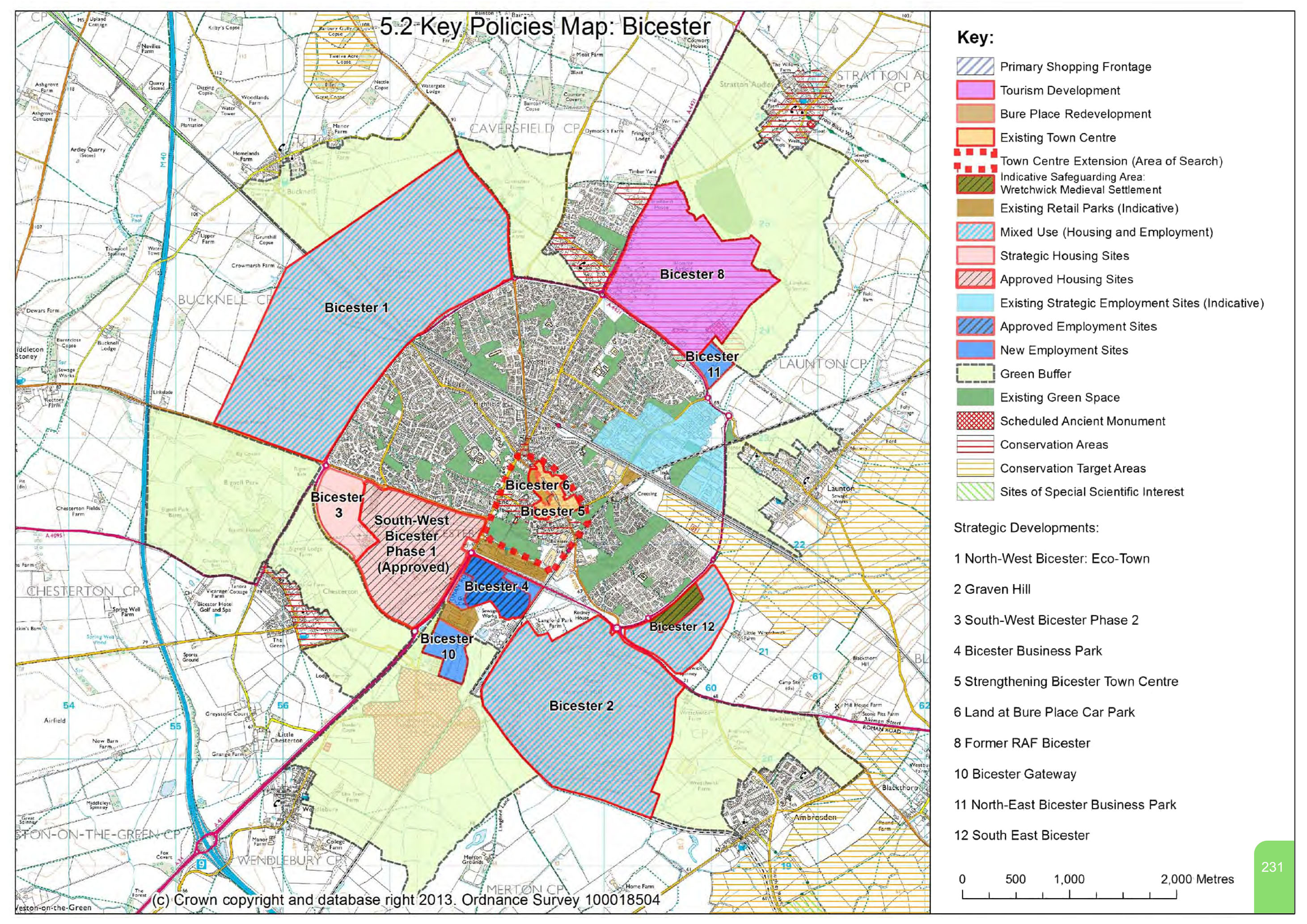
The revised Cherwell Local Plan (Jan 2014) shows Gavray Meadows returned to its original status as a Conservation Target Area. The Key Policies Map showing this can be viewed here. Further details can be accessed on the CDC webpage “Local Plan Submission Documents” by selecting SUB01 – Part 1 (4.3Mb download) and SUB01 – Part 2 (3.6Mb download).
The retention of Gavray Meadows as part of the Ray Conservation Target Area is an achievement for our campaign, although this current submission of the Cherwell Local Plan still needs the approval of an independent planning expert, Nigel Payne.
ORIGINAL ARTICLE 19th January 2014: Shortly the development company Gallagher Estates will be re-presenting their proposals to Cherwell District Council to build on the land between Gavray Drive and the main Chiltern railway to London Marylebone.
Whether it be 500 houses or light industry, the development will contribute a lot of extra traffic (especially construction lorries) and pollution from diesel fumes. It will also increase the risk of flooding on our estate due to more hard surfaces (roads, tarmac and roofs) being unable to absorb rain-water. You will have seen how much water accumulates already on Langford Fields.
The site was marked as a Local Wildlife Site by the Council and is still designated as such by the Thames Valley Environmental Record Centre (search for site 52W01, Oxfordshire on their website). It is a rare surviving example of unimproved neutral flood meadow grassland, classification MG4. The flora is typical of lowland meadows and/or floodplain grazing marsh, see http://www.oncf.org.uk/biodiversity/Lowland%20Meadows%20and%20Floodplain%20Grazing%20Marsh.pdf
Its area is now about 20 hectares in all, including land to the west of the Langford Brook. For comparison, the celebrated Berkshire, Buckinghamshire and Oxfordshire Wildlife Trust nature reserve at Chimney Meadow is about 27 hectares and other similar BBOWT sites are less than 10 hectares in area, with the exception of Yarnton Meads. In the whole of Oxfordshire there is only c.143 hectares of MG4 grassland.
The habitat supports many unusual butterflies, some rare such as the black hairstreak, the brown hairstreak and the grizzled skipper, which last two I have photographed (along with 16 more butterfly species) at Gavray Meadows last summer (2013). It also has a long farming history connected to farms at Launton which are fast disappearing.
If we are not to lose this superb wildlife site permanently for our children, as a place on our doorstep where we can observe and learn about wildlife, we must act now. The Bicester Advertiser is running a big article about our Campaign to Save Gavray Wildlife Site in February. Please show your support by buying the Advertiser running the article. Please also visit our Facebook page https://www.facebook.com/savegavraywildlifemeadows and “like it.”
Because Chiltern Rail has taken up land to the north of the Gavray site and has contributed drastically to the water-table there, Gallagher will need to alter its plans for this section; Chiltern Rail has warned Gallagher that a buffer zone of 5 metres must be left between houses or gardens and the railway. We are also awaiting results of the reptile survey from the Environmental Dimension Partnership, and details regarding flooding and sewage from the Environmental Agency and Thames Water.
When the Gallaghers new Planning Application comes up for renewal (we think in March) please write to your councillors Dan Sames and Lynn Pratt cllr.daniel.sames@cherwell-dc.gov.uk. and cllr.lynn.pratt@cherwell-dc.gov.uk. saying that you value the site for wildlife, as an educational resource and as an open green-space which is not “manicured”. Lynn Pratt is also on the Town Council.
Comments on the current Planning Applications via the CDC website are now closed, but details of these applications can still be viewed via http://www.publicaccess.cherwell.gov.uk/online-applications by typing 10/01667/OUT into the search box. Full details are available in the Associated Documents for each application.
For an overview of the development, the Gavray Drive Masterplan (2012) can be also be accessed here (7.2Mb download).
Comments on the Gavray Drive development can meanwhile still be made by email to planning@cherwell-dc.gov.uk, marking them clearly “Land between London-Birmingham Railway Line and Gavray Drive” to avoid any confusion between differently-numbered applications for this development.
Please look on our Facebook page later for more detailed instructions, or on the LVCA website. (Patricia Clissold, January 2014)
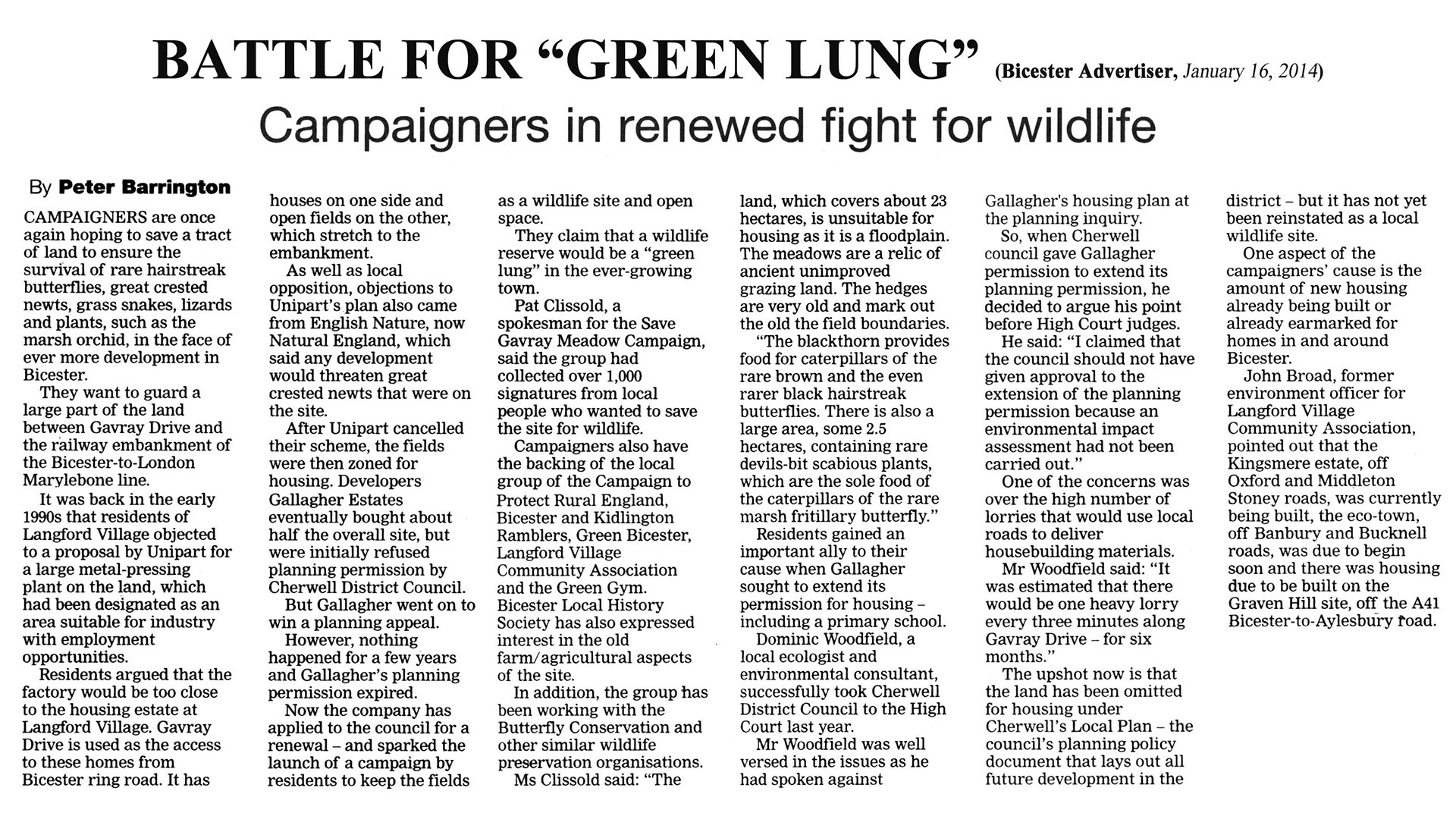
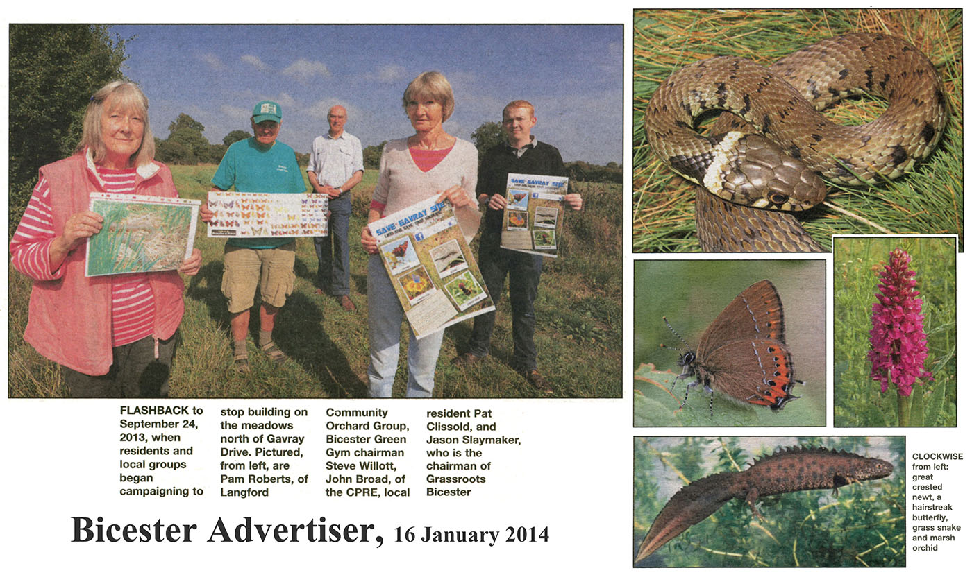
The campaign for the Gavray Wildlife Site featured in the Bicester Advertiser on 16th January 2014. To view this article click on the following links:
1. Main Article
2. Pictures


